Railway Park Location
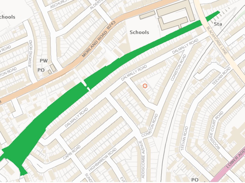
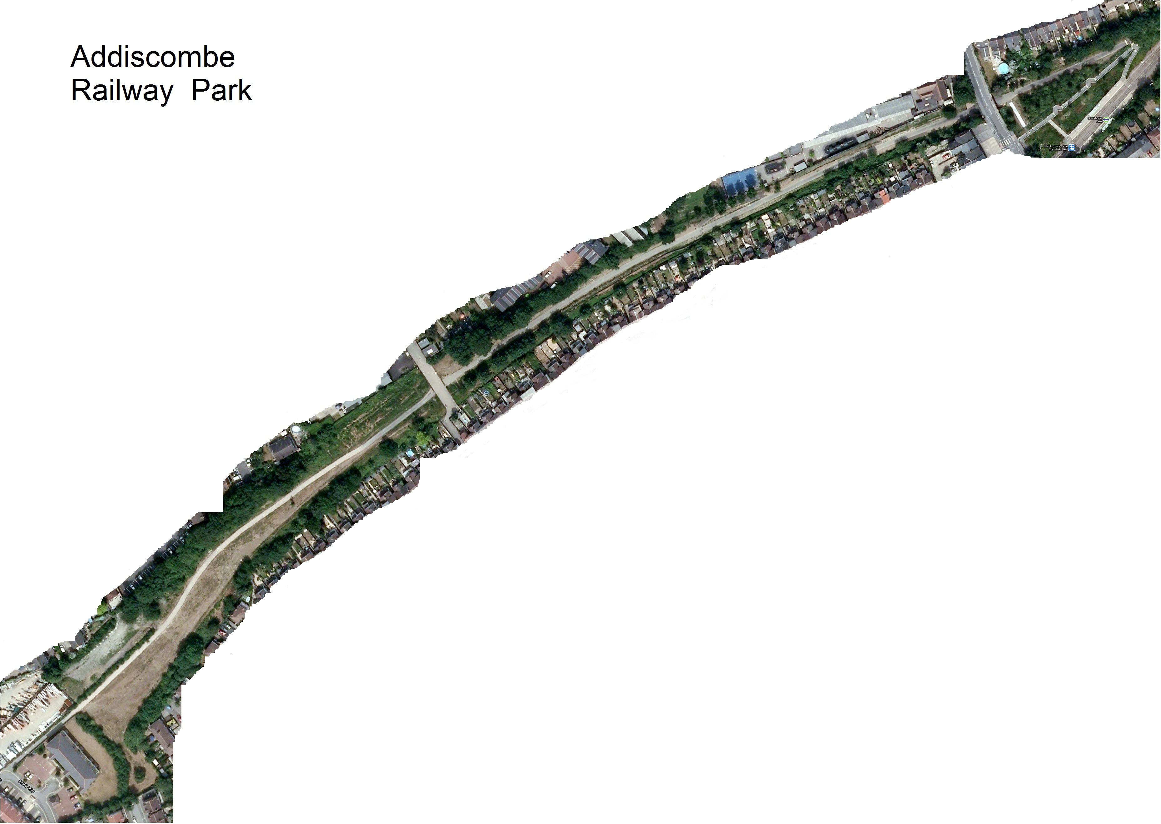
The park is situated between Morland Road to the North and Dalmally Road to the South. The park occupies 1.3 hectares (3.3 acres) and is approximately 800 metres long.
Access to the park
Entrances are located at :
- The Blackhorse Lane Tram Stop entrance is at the North of the park.
- Dalmally Passage which links Morland Road at the pedestrian crossing with Dalmally Road providing access to the centre of the park.
- The East India Way is to the South of the Park.
Available Maps
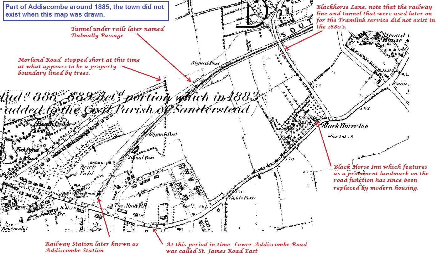
Historical map of the railway route from around 1885
Map showing the extent of the Railway Park today
Large scale satellite image of the Railway Park 2008